


Welcome to Ulaanbaatar (UB)—a city where you might see a high-tech skyscraper casting a shadow over a traditional felt ger, and where the pulse of modern commerce beats in sync with ancient Buddhist chants.
Situated at the confluence of the Tuul and Selbe rivers, Ulaanbaatar is a city defined by its dramatic geography. It sits nestled in a valley at an average altitude of 1351 meters, guarded by four majestic sacred mountains. To the south lies Bogd Khaan Mountain, a peak that has watched over the city’s evolution from a mobile monastery to a sprawling metropolis.
A History of Ulaanbaatar (Red Hero)
Ulaanbaatar wasn't always the concrete hub it is today. In fact, for a long time, it was a city on the move.
The Foundation
The city’s story began in 1639 with Zanabazar, the first spiritual leader of the Khalkha Mongols and a direct descendant of Genghis Khan. Originally called Orgoo (Palace), it was established as a nomadic Buddhist center. The goal was simple but ambitious: create a centralized power to unify Mongolians against the rising Manchu (Qing) Dynasty.
The 28 Moves
Ulaanbaatar might be the only capital city with a serious case of wanderlust. Between its founding and its final settlement, the city changed locations 28 times, migrating along the Orkhon, Tamir, and Tuul rivers. It finally "parked" in its current location in 1778, then known as Ikh Khuree.
Evolution of the "Red Hero"
The city has many names: Orgoo, Nomiin Khuree, Ikh Khuree, Da Khuree and Niislel Khuree (Capital City). It wasn't until October 29, 1924, following the revolution and the declaration of the Mongolian People's Republic, that it was officially named Ulaanbaatar, which translates to Red Hero.

The "White Fairy of Asia"
While the city's ancient roots are nomadic, its mid-20th-century transformation earned it a glowing reputation as "The White Fairy of Asia". During the Soviet era, Ulaanbaatar underwent a rapid architectural metamorphosis that many considered a miracle of urban planning.
Grand Neoclassical Buildings: Stately structures with white and pastel facades that gave the city a clean, luminous glow.
Wide Boulevards: Spacious avenues like Peace Avenue were laid out to accommodate a growing modern society.
Planned Neighborhoods: The construction of the "micro-districts" brought modern heating, plumbing, and centralized infrastructure to the high-altitude steppe for the first time.
This visual contrast, along with its planned layout and clean aesthetic, led visitors and planners to describe the capital as the "White Fairy" of the East, blending European-style socialist classicism with the vast, open horizons of the Mongolian landscape.
UB by the Numbers
ESTABLISHED
POPULATION
TOTAL AREA
STRUCTURE
1639
1,768,151 (as of 2024)
4,700 sq. km
9 Districts & 122 Khoroos
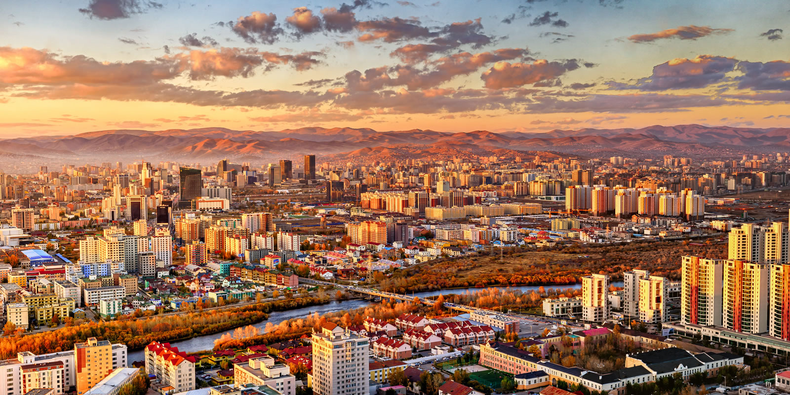
A Modern Capital with a Traditional Soul
Today, Ulaanbaatar is a city of contrasts. While the livestock that once roamed the city center are largely gone, the "Ger districts" in the sprawling suburbs still house thousands who maintain a semi-traditional lifestyle within the city limits.
The skyline is a mix of Soviet-era architecture, glass-faced business towers, and historic sites like the Gandan Tegchenling Monastery (established in 1809). It is a city that feels both ancient and brand-new—a place where you can grab a world-class espresso before visiting a temple that has survived centuries of political upheaval.
Whether you're navigating the busy traffic of Peace Avenue or hiking the trails of Bogd Khaan Mountain, Ulaanbaatar offers a unique glimpse into a nation that is rapidly developing while keeping its nomadic heritage firmly in its heart.
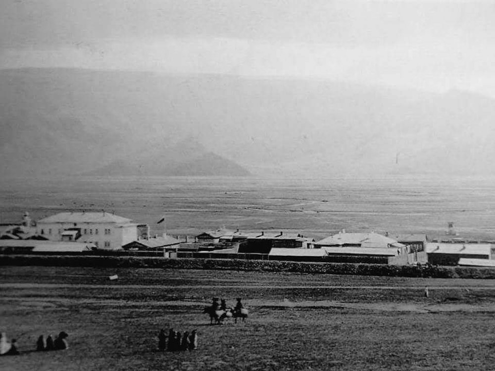
Consular Hill (Konsulyn Denj) area of Niislel Khuree, Ulaanbaatar in 1912.

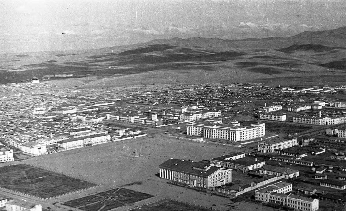
Ulaanbaatar in 1930s.
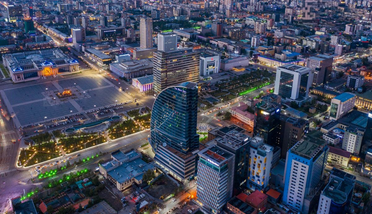
Ulaanbaatar in 1950s.
Ulaanbaatar Today
